Madhugiri is an individual hill rising upto around 4000 feet
is the second largest monolith in Asia. It is
located 105 Km North West of Bangalore. The fort Madhugiri
built on this hill, is considered to be one of the finest forts in Karnataka.
It is said, The Ganga Dynasty, dominated by the Jains began
the construction of the fort. Raja Heera Gowda of the Vijayanagar dynasty
completed the fort. It was ultimately taken over by HyderAli/Tipu Sultan and at
last became a part of the Mysore Empire under the British control. It is
currently managed by Archaeological Survey of India.
The monolithic hill is surrounded by many rounds of walls as
protective boundaries. At places the climb can be steep. The view of the
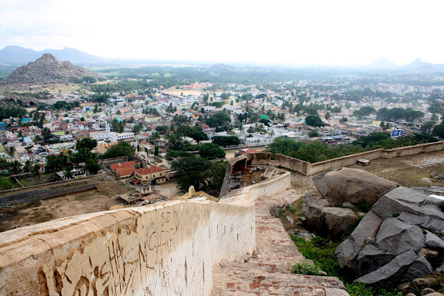
Madhugiri town and the surrounding from the top is awesome. Small isolated
hills in the vicinity also add to the view.
The trek started at the Mughal style arch at the entrance of
the fort. The initial section has some well layed steps and we
expected the same till the end but within the short distance start the actual
means of traveling to the top, a small box shaped step etched into the boulders
to give the much needed grip for the legs.
After 20minutes we reached the halfway point. We decided to
rest for a while. This point offers some spectacular view of the hills
surrounding the fort.
From this point on there were no support railings and no
steps carved out. Walking on steep rocks without support is not that difficult
provided we follow the basic rule of rock climbing. A good pair of shoes
will definitely come in handy in this situation.
We reached the top in 50mins. The moment we reached the top
we got a feeling as if someone had put a gigantic cover over our head. blocking
the sun’s heat and switching on natural a/c a.k.a Wind. We had a
wonderful view of the town Madhugiri and hills close by. On the top there
was a small fort, nothing spectacular but beautiful nonetheless.
Descending is always easy compared to climbing up and thus
we could climb down the hill in an hour or so. As we drove back, the huge rock
was running behind us as if we are going to destroy it, and finally it ran away
from our eye sight in 15 minutes.
Some clicks:
Madhugiri hill as seen from the out side the town Madhugiri - Bangalore route.
Madhugiri Hill as seen from Madhugiri Bus Stand. The climb starts right from Madhugiri Town
Majestic view of Madhugiri Fort from the Bus Stand
Temple in the entrance. It was closed when we went hence could not enter inside.
Ruins of Madhugiri near the entrance. These places are called Mantapam where meetings or Panchayaths are held.
Intial Fort entrance. There were many entrance gates like this.
Madhugiri Fort main entrance gate
Passage to another hill inside the fort.
Second part of the hill.
Madhugiri Town as seen from Second Part of the hill.
Broken Windows
Pond on Hill !!!! Yes people say Hydar Ali built this to save the water in rainy season to use it in the summer.
Pond system. This Small pond is connected from the top the hill where rain water never go waste.
Small Ganesha temple on the way to summit.
Climbing hill is not easy.
Madhugiri town from the Thirt part of the hill.

Yes this is toughest part of the climbing. 70 degree vertical hill.
Hill Lizard on hunting.
Plenty of cactus trees are there on the way to top.
Cococnut farm as seen from the top.
Jai Sri Ram. This is the temple (No statue now) entrance on the top of the hill.
Temple Prangana
These two man made dibbas were used to store rice and grams.
Hyder Ali's godown ....:-p
A bug on sleep.
Yes were on top of the hill
Temple on top
Am I wearing matching colour dress
How to reach:
Route 1: Bangalore
– Nelamangala - Dobbaspet (right turn) – Koratagere – Madhugiri (105 Km) – Best
route.
Route 2:
Bangalore – Doddaballapur – Gauribidanur – Madhugiri (120 Km) –. This
route is best for the people living in North of Bangalore (Yelahanka, Hebbal
etc)
Happy touring...............
Gokul


No comments:
Post a Comment